

Abstract
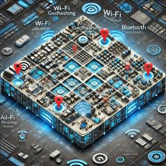
This Real-Time Geolocation Software, backed by a US patent, is an advanced tracking and route-optimizing tool that represents a breakthrough in asset monitoring and management. Utilizing geohashing technology, it divides large areas into small, coded segments for highly precise, real-time location tracking. By integrating data from multiple sources—such as GPS, Wi-Fi, Bluetooth, and RFID—the software overcomes the limitations of traditional GPS, especially in complex indoor or crowded environments. Constantly analyzing real-time data, it optimizes routes, predicts wait times, and improves operational flow, enabling swift responses to changes and enhancing service quality. By boosting operational efficiency and offering unparalleled visibility and control, this innovative solution provides businesses with a unique competitive advantage.
Description
The system uses micro-geohashing to create a fine-grained map that identifies location density and movement patterns within small areas. Through real-time density analysis and predictive modeling, it adjusts routes dynamically, providing guidance and estimated wait times based on immediate conditions. It integrates historical data with real-time movement to make highly accurate predictions on wait times or crowding, allowing users or operators to respond instantly to changing situations.
Value Proposition
The software brings significant advantages:
- Precision Tracking: Tracks assets, people, or equipment within confined spaces with high accuracy.
- Enhanced Operational Efficiency: Reduces delays and optimizes routes, allowing for smoother movement and resource allocation.
- Improved Customer and Visitor Experience: Provides real-time updates and alternative routes to avoid delays, reducing frustration and wait times.
- Versatile Applications: Useful in diverse environments beyond roads, such as warehouses, hospitals, airports, and event venues where conventional GPS falls short.
Case Studies (Examples of Application)
1. Airports and Large Transit Hubs
- Example: Tracking passenger flow in security checkpoints, boarding areas, or baggage claim sections.
- Limitations of GPS: Conventional GPS lacks accuracy indoors due to interference from structures, resulting in location "drift" or inaccuracies.
- Benefits of This Technology: Micro-geohashing and sensor fusion allow precise tracking within specific areas of an airport. It can monitor congestion in real-time and predict wait times at security or boarding, dynamically suggesting less crowded areas for faster navigation.
2. Shopping Malls and Retail Centers
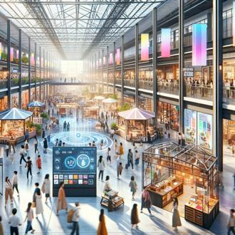
- Example: Optimizing customer flow, locating high-traffic areas, and managing line wait times at stores or food courts.
- Limitations of GPS: Indoors, GPS struggles with accuracy, and it doesn't offer insights into dense or specific parts of a building like a single store.
- Benefits of This Technology: By using Bluetooth and Wi-Fi signals along with micro-geohashing, this system can track customer movement across specific mall sections, helping retailers analyze foot traffic patterns and manage staffing or promotions in real time.
3. Warehouse and Logistics Centers
- Example: Tracking equipment, personnel, and inventory within different aisles or sections.
- Limitations of GPS: Warehouse layouts often block GPS signals, and traditional GPS can’t distinguish between close aisles or indoor sections.
- Benefits of This Technology: This solution provides real-time insights into specific zones within a warehouse (like shelves or aisles). It helps with inventory tracking, reduces equipment retrieval time, and optimizes workforce movements to boost efficiency.
4. Theme Parks and Large Event Venues
- Example: Managing crowd flow and reducing wait times for rides or concessions.
- Limitations of GPS: In crowded or overlapping areas, GPS struggles with accuracy, and it lacks real-time predictive capabilities for wait times.
- Benefits of This Technology: The system can monitor specific locations like ride queues or restrooms, providing up-to-date wait-time predictions and guiding visitors toward less crowded areas. It enhances visitor experience by reducing congestion and improving facility management.
5. Construction Sites and Industrial Facilities
- Example: Monitoring personnel and heavy machinery movements within complex construction sites.
- Limitations of GPS: Conventional GPS is insufficient for tracking inside multi-level sites or dense infrastructure environments where precision is critical.
- Benefits of This Technology: With micro-geohashing, this solution tracks specific areas (like scaffolding levels or zones with restricted access), enhancing safety and operational efficiency by providing real-time location updates and alerts for overcrowded or restricted zones.
6. Sports Stadiums and Concert Arenas
- Example: Optimizing crowd flow and concession management, and providing real-time updates on entry/exit wait times.
- Limitations of GPS: Stadiums block GPS signals, and GPS-based solutions can’t provide real-time density data for individual sections or aisles.
- Benefits of This Technology: The system can track the density within specific stadium sections, manage concession stand lines, and reroute people to open areas, improving the overall fan experience by reducing wait times and avoiding congestion.
7. Hospitals and Large Healthcare Facilities
- Example: Tracking equipment, patients, and staff in real-time across different wards or departments.
- Limitations of GPS: GPS lacks the precision to track medical equipment or staff in specific rooms or floors within a building.
- Benefits of This Technology: This technology allows hospitals to manage real-time tracking of assets and people down to the room level, which improves response times, reduces equipment search times, and enhances patient flow management, particularly during emergencies.
Innovative Aspects
This solution stands out for its:
- Micro-Geohashing Precision: Unlike standard GPS, it divides spaces into small geohash segments, enabling precise tracking in confined or indoor areas.
- Real-Time Density Analysis and Wait-Time Prediction: Combines real-time and historical data for accurate, live predictions on crowd density and wait times.
- Multi-Source Data Fusion: Integrates various tracking signals (e.g., GPS, Wi-Fi, Bluetooth) for greater accuracy in areas where GPS alone is unreliable.
- Edge Computing for Fast Processing: Uses edge computing to process data close to its source, minimizing delays and allowing for instant updates in dynamic environments.
- Privacy-Focused Design: Built with opt-in tracking in specific zones, respecting privacy while delivering targeted, accurate data.
Pricing Options
- Per user: based on demand
Targeted Customers
- Banking and Fintech
- Hr tech
- Tourism and Transportation Tech
- Taxi Companies
- Information and Communications Technology (ICT)
- Retail Tech
- Training and Educational Institutions
- Virtual Event Organizers
- Automotive Industry Companies
- Mining Companies
- Logistics, Supply Chain and Transport Companies
- Telecommunications Companies
- Tourist Groups
- Business Travelers
Solution Type
- Saas Software
- API
Customizable
Value proposition
- Hardware-Free Precision
- Comprehensive Insights
- Flexibility and Adaptability
- Real-Time Indoor Location Tracking
- Accurate Geopositioning Data
- Improved Customer Experience
Gallery

Air Travel Experience with Real-Time Geo-Locator Solutions
your customers will know, in real-time, exactly how long it will take them to get from their home to the gate terminal, accounting for every ...

Retail Insights
Beyond Beacons, No Hardware Needed, Seamless CRM Integration

Heavy industry
monitor your greatest assets in real time, prioritizing the safety and well-being of your employees above all else. Heavy industry has endur ...